
Bangkok is famous for its canals or khlongs with tourist brochures promoting the city as having once been “The Venice of the East”. In fact the history of Thailand’s canals is older than Bangkok itself. The “Venice of the East” description was originally from the Portuguese explorer Fernão Mendes Pinto writing about Ayutthaya in the 1540’s. But why were there so many canals, when were they built and why are they to blame for Bangkok’s terrible traffic-jams today?
Short Cuts to Ayutthaya
Ayutthaya emerged as the centre of powerful state known as Siam around 1350. Located strategically at the confluence of the Lop Buri and Pasak rivers early canal building was focussed on shortening trade routes. One of the earliest canals dug appears to have been Khlong Maha Phram to the north-west of the city which connected with the Chao Phraya River, which at that time ran a few kilometers west of Ayutthaya (It wasn’t until 1857 that another canal diverted the Chao Phraya River to Ayutthaya). From an early period the city was criss-crossed by canals which served as the main means of transportation within the city. The city was only completely surrounded by a moat in 1584 when a canal on the eastern side was widened and deepened in preparation for an expected Burmese attack.
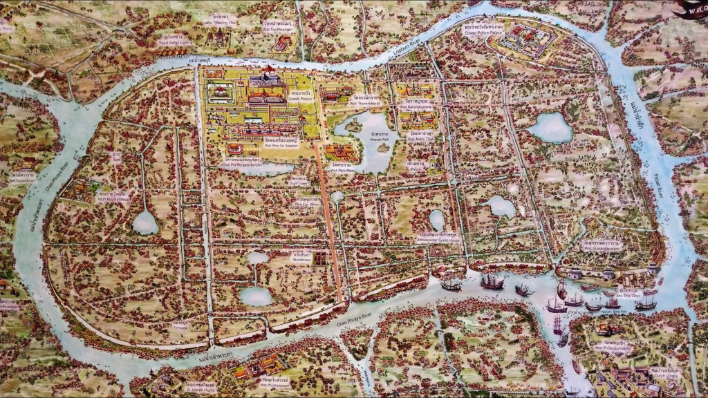
Ayutthaya grew tremendously wealthy from international trade which predominantly came by sea via the meandering Chao Phraya river. For all merchants time is money and they no doubt expressed frustration at the many additional days it took their ships to navigate around the long loops in the river.
Construction of the first major short cut canal or khlong lat was ordered by King Chaiyarachathirat (r.1533 – 1546) at the small village of Bangkok. A 15km loop of the river was eliminated by a 2km length of canal. On completion in 1552 the waters rushed through this new canal widening and deepening it whilst the original channel silted up and narrowed. That original channel is today known as Khlong Bangkok Noi, the site of Siriraj Hospital, and emerges again at Khlong Bangkok Yai, the site of Wang Derm. Few people realise that this most famous stretch of the Chao Phraya River in front of Wat Arun and the Grand Palace is not the river’s natural course.

Around 1630 King Prasat Thong ordered the cutting of a 5km long canal in modern day Nonthaburi which eliminated another 20km stretch of the river. Again the river’s original course can still be found as Khlong Om Non by the Maha-Chesadabodindranusorn Bridge and emerging down stream again as Khlong Bang Kruai shortly before Rama VII bridge.
Two other short cut canals are well known to Bangkokians but the dates of their origin are not clear. In Nonthaburi the 2km long Khlong Lat Kret Noi eliminated a 6km loop of the river and created the island of Koh Kret, today popular for its busy weekend market. The royal chronicles say that King Phumintharacha ordered the digging of this canal in 1722 but European maps of the river made several decades earlier already show Khlong Lat Kret Noi.
Similarly the date of origin is not clear for the 600m long Khlong Lat Pho which short cut an 18km loop of the river and created the island of Phra Pradaeng, now known as Bangkok’s “Green Lungs”, that provide an oasis of unspoilt greenery just a few hundred meters from Bangkok’s concrete urban centre.

Linking the Major Rivers
Two other major canals from the Ayuttahaya period did not short-cut the Chao Phraya River but were “transverse canals” dug with the intention of improving transportation to the east and west.
To the east Khlong Samrong runs from the Chao Phraya River opposite Phra Pradaeng to join the Bang Pakong River 50km to the east. The date at which this canal was dug is unknown but it is recorded that King Ramathibodi II ordered improvements in 1498 due to silting problems. The area through which this canal was dug was barren and sparsely populated so its main function must have been to improve transportation to the west.
To the west the Khlong Mahachai runs approximately 30km from the Chao Phraya River to the mouth of the Tha Chin River at Samut Sakhon. The royal chronicles record that King Phra Phuttha Chao Sua ordered the construction in 1704 because the existing canal “was so tortuous that it was troublesome for people to row their boats along it. Their route is long and circuitous. So the meandering parts should be made straight.” It was the first canal construction to use scientific surveying methods introduced by Europeans (Compare with the surveying of the road to Wat Phra Putthabat in Saraburi) but took until 1721 to complete, possibly delayed by the king’s death in 1709. Again this area was barren and sparsely populated at the time and the canal’s main purpose was to improve communication and transportation to the west and onwards to the southern provinces.

Defending the Kingdom
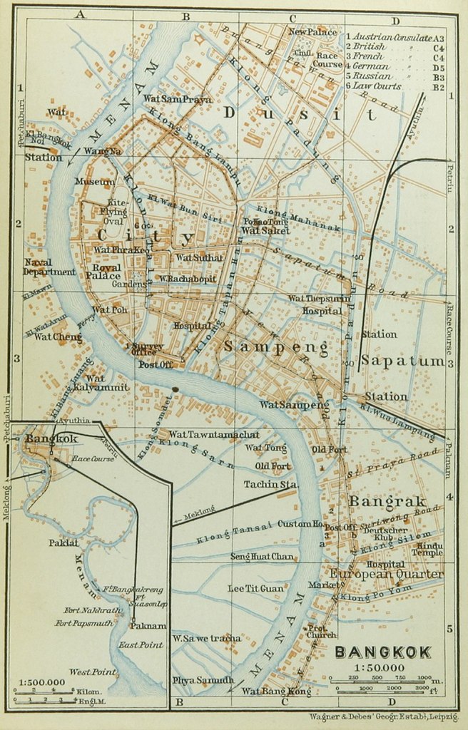
In 1767 Ayutthaya was destroyed by the Burmese and the Thais fell back to the south establishing a new capital at Thonburi. The move to the lower part of the Chao Phraya River was driven by the necessity of improved communications for international trade but defence was now a primary concern. As well as building defences around Thonburi King Taksin had a moat dug and defensive wall built on the eastern side of the Chao Phraya River. Today known as Khlong Khu Mueng Doem (“Old City Canal”), it was created by joining the old Khlong Rong Mai, today hidden under Phra Pin Klao Bridge, to Khlong Talat which joins the Chao Phraya river by Rachini School, just 500m south of Wat Pho.
When King Phra Phuttayotfa (Rama I) came to power in 1782 he immediately moved the capital across the river, establishing Krung Thep (“City of Angels”), at the location of Bangkok within the defensive inner moat dug by his predecessor. He then ordered an additional outer moat to be dug, Khlong Rop Krung (“Canal around the city”), by connecting the old Khlong Banglamphu at the northern end with Khlong Ong Ang which met the river where Phra Pok Klao Bridge now stands. Two small canals were cut joining the inner and outer moat, both originally being known simply as Khlong Lot or “tube canals”.

In Bangkok’s early years much of the construction was intended to recreate the splendour of Ayutthaya. In a similar way King Rama I also ordered the excavation of Khlong Mahanak east from Khlong Rop Krung and running north of Wat Saket. The royal chronicles record that this canal was dug “so that the city people could assemble, in boats, to perform music and to recite poetry as in the rainy season ceremony of the old capital, Ayutthaya.”
In 1837 however military matters were again in mind when King Phra Nangklao (Rama III) ordered the construction of Bangkok’s famous Khlong Saen Saeb. At this time Siam was fighting the Vietnamese for control of Cambodian territory so a new canal was needed to provide fast transportation of troops and supplies to the east. Khlong Saen Saeb starts as an extension of Khlong Mahanak and like the much older Khlong Samrong runs for 50km to join with the Bang Pakong River which could then be used to transport troops to the Cambodian territories.

Road Building for Europeans
In 1851 King Mongkut (Rama IV) began his reign by ordering the digging of a new city moat, Khlong Phadung Krung Kasem. In his own words “The previous three kings ordered canals to be excavated for the people’s benefit. In these days, as the nation has attained prosperity and the population of the capital has increased greatly, the city area should be expanded. The population of common people has become much larger. Houses and residences of officials and common people are mostly outside the city area.”
Khlong Phadung Krung Kasem was dug approximately 1km east of the old city moat Khlong Rop Krung. It starts just upriver from Rama 8 Bridge and runs south for 5.5km rejoining the river opposite Icon Siam shopping complex. When it was dug this new city boundary doubled the area of Bangkok.
As trade with Europe increased in the nineteenth century merchants were once again complaining about the time spent navigating the winding Chao Phraya River. In1857 the European consuls in Bangkok wrote to the king saying “Merchant vessels must go enormous distances to reach Bangkok. In the rainy season, because of the strong current, a ship must waste many days before reaching Bangkok. Let our commercial establishments move to the south of the mouth of the Phra Khanong canal in Bang Na District. And we ask that a short-cut canal be excavated from Bang Na District to the Phadung Krung Kasem canal.”
King Mongkut agreed to this proposal and a new canal was dug called Khlong Thanon Trong (“Straight Road Canal”), known today as Khlong Hualampong. In a sign of coming times the mud excavated in digging the canal was used to build a road along the northern side of the canal. In 1919 this road was renamed Rama IV Road.
Despite the the building of Khlong Thanon Trong the European community did not move out of their enclave centred around Bang Rak south of Khlong Phadung Kasem. But their complaints to the king did not cease, who was informed next that the lack of roads for their horse-drawn carriages was causing ill-health amongst the Europeans. This resulted in the building of Thanon Charoen Krung (“Prosperous City Road”) in 1864, initially known just as Thanon Mai or “New Road”, a name which stuck with the Europeans.
The complaints from the Europeans in fact prompted a program of road building which was often associated with new canals. For example the digging of Khlong Bangrak west from Khlong Thanon Trong to the Chao Phraya River created Silom Road. Similarly a wealthy Chinese-Thai Yom Phisonbut financed a canal parallel to Khlong Bangrak with roads either side of the canal. Initially known as Khlong Poh Yom (“Mr Yom Canal”) the dual roads are today known as Sathorn Road after Mr Yom’s royally bestowed name of Luang Sathorn Rachayut.
Another canal was dug in 1905 connecting Khlong Saen Saeb with Khlong Hualampong 2km to the south. To control the water flow from Khlong Saen Saeb a water gate or pratu nam was built in the grounds of Sa Pathum Palace (Now the official residence of Princess Sirindhorn). Known originally as Pratunam Wang Sa Pathum this watergate eventually gave its name to the Bangkok’s famous shopping district Pratunam.

The Pratunam district is named after the water gate that controlled water flow into the canal
Irrigation and Commercialisation
Whilst Siamese governments had invested in major canals to address transportation and military issues, the digging of canals for crop irrigation seems to have been traditionally left to local communities who would adapt the course of rivers and local water courses to suit their needs. But in 1855 Siam signed the Bowring Treaty with Britain which ended the traditional royal monopolies on trade. This treaty initiated a process of economic transformation in Siam. No longer able to rely on trading monopolies for their income the Thai elite now turned to cash crops such as sugar-cane and rice. This prompted the digging of three major canals west of Bangkok to open up this region for rice cultivation.
The first of these canals was Khlong Mahasawat which today marks the boundary between Bangkok and Nonthaburi administrations. It was ordered by King Mongkut in 1857, cutting through mainly unoccupied land from Khlong Bang Kruai to the Thai Chin river. It was a significant financial investment costing some 4.4% of the national budget. Under a royal act of 1861 narrow plots of land measuring 2.4km x 216m were allocated to members of the royal family in order to cultivate rice using either traditional debt-slaves or free tenant peasants as labour. In fact shortage of labour in the region was a continual hinderance to King Mongkut’s plans with the transition to free tenant labour only happening gradually. The transition of the area to cultivated rice land took much longer than envisaged.
In 1865 a Chinese-Thai opium and sugar-cane tax farmer, Phra Phasi Sombat Borirun, financed the construction of Khlong Phasi Charoen (“Prosperous Tax Canal”) from Bangkok Yai to Nakhon Chaisi, to both improve transportation of his sugar-cane to Bangkok and to open up the surrounding land for cultivation. Thoroughly modern in his commercial ideas, Phra Phasi proposed to finance the construction by charging tolls on the canal or by open gambling houses at Nakhon Chaisi. It is not clear if any of these plans were implemented.
Then in 1868 (The year King Mongkut died) Chao Phraya Sri Suriyawongse (Chuang Bunnag) helped fund the construction of Khlong Damnoen Saduak (“Convenient Route Canal”). This canal extended Khlong Phasi Charoen further west to the Mae Klong River in order to ease transportation of rice, fruit and vegetables from the Ratchaburi area. The finances that Chao Phraya Sri Suriyawongse spent on this project were the balance of revenues from sugar cane taxes that King Mongkut had put under his charge in order to finance the construction of Phra Nakhorn Khiri Palace. Whilst building the canal Suriyawongse also took the opportunity to acquire large tracts of land alongside the canal which he allocated to his wives and family.
As new land was opened up to commercially driven cultivation, ownership of land, which had traditionally been viewed as a status symbol, now became an increasingly lucrative investment. Financial speculation in land expanded amongst Siam’s elite. One example was the formation in 1888 of the Siam Canals, Land and Irrigation Company by Sai Santiwong, a member of the royal family and the Director of the Customs Department, two Chinese-Thai tax farmers (One of whom was Yom Phisonbut responsible for Sathorn Road) and Joachim Grassi, an Italian/Austrian architect who built Bangkok’s famous Old Customs House.
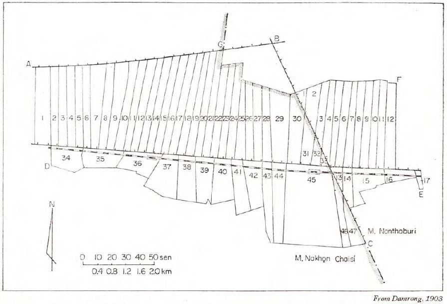
With significant investment from both the king and the government the Siam Canals, Land and Irrigation Company began work on the Rangsit Project in a largely unpopulated area north-east of Bangkok. The main trunk Khlong Rangsit ran 55km from the Chao Phraya River west to the Nakhon Nayok River whilst running north and south from this trunk were 42 secondary canals. To the north the longest secondary canals ran 21km to another new canal Khlong Raphiphat whilst to the south they reached 12km to Khlong Hok Wa. For the first time gates at the mouth of the canal could be raised or lowered to control the flows of water.
The meticulously laid out canal system of Rangsit is still clearly visible on any map of the area. Financially the scheme was very lucrative for its investors who benefited from rising land values and who often integrated their new commercial rice-growing operations with existing rice milling operations. But as an irrigation scheme the project had several problems. Despite the water gates controlling flows, the scheme was unable to bring more water to the area in times of shortage, the main cause of crop failure. Silting also proved to be a significant problem due to the secondary canals being too narrow. After ten years less than 40% of the land area covered had actually been cultivated.
With these problems in mind the Siam government in 1902 hired the services of a Dutch hydraulics engineer, Mr J. Homan van der Heide. In January 1903 van der Heide’s report proposed a bold scheme to dam the Chao Phraya River at Chainat some 160km north of Bangkok and divert waters into a network of canals in the lower delta region which could provide for irrigation even when water levels were low.
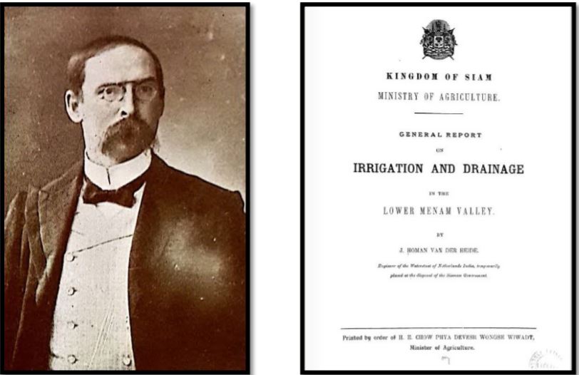
In response the government established the Royal Irrigation Department but funds to implement van der Heide’s scheme, which would have been a considerable proportion of the national budget, were never allocated. Instead smaller projects were financed with the idea that they could later be incorporated into the larger scheme. Delayed by World War I, followed by recession and then World War II it was not until 1957 that a diversionary dam at Chainat was completed, having been financed by an $18 Million loan from the International Bank for Reconstruction and Development. The irrigation scheme first proposed by van der Heide in 1903 as a twelve year project was finally completed in the early 1960’s. For the first time it was now possible to grow a second crop of rice each year during the dry season in the Chao Phraya delta.
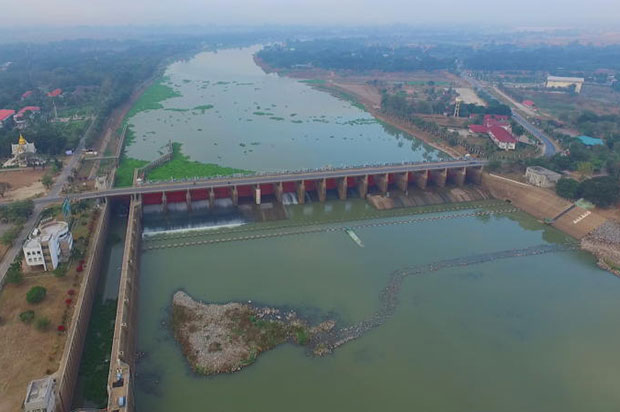
Photo Credit: Bangkok Post
From Transportation to Traffic Jams
During the twentieth century Bangkok transformed from a small city on the banks of the Chao Phraya River to a vast urban metropolis of more than 10 million inhabitants spread over 1,569km². Many of the old canals disappeared under the new transport network of concrete roads. Sitting in the traffic of modern day Bangkok it is very hard to visualise how the old water borne city would have been. But the legacy of that earlier era still impacts the life of Bangkokians.
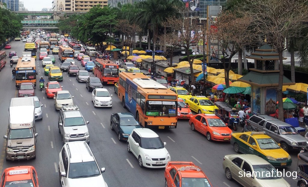
From its very beginnings the road network mirrored the old canal network and as land outside of Rattanakosin Island was divided up into narrow blocks by wealthy families the road map of Bangkok’s future suburbs was also being laid out accidently. The major trunk canals have become the routes of Bangkok’s major roads whilst the interconnecting secondary canals have been filled in to form Bangkok’s familiar narrow sois. A consequence of this pattern of development is Bangkok’s extremely low area of road space. In New York 32% of the city’s area is road space; in Tokyo this percentage is 23%. But in Bangkok just 8% of its area is given to roads, a root cause of its notorious traffic jams.
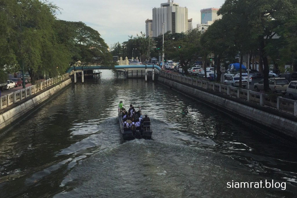
And so it is that in the twenty first century the quickest way to get across Bangkok may not be by car but rather by catching a canal boat and reverting to Thailand’s oldest means of transport.
Did You Enjoy This Article ?

Where to Go
References
- Tanabe, Shigeharu. Historical Geography of the Canal System in the Chao Phraya River Delta. Journal of the Siam Society. Vol 65.
- Small, Leslie. The Historical Development of the Greater Chao Phraya Water Control Project. Journal of the Siam Society. Vol 61.
- King, Ross. Reading Bangkok. NUS Press 2011.
- Akira, Suehiro. Capital Accumulation in Thailand 1855 – 1985. Silkworm Books. 1996.
- https://www.ayutthaya-history.com/Essays_Waterways.html
- https://www.bangkokpost.com/opinion/opinion/1762349/understanding-bangkoks-traffic-woes
Note : This article was updated on 14th August 2022 to correct the fact that Khlong Khu Mueng Doem (“Old City Canal”) was dug during the reign of King Taksin, not Rama I as previously stated. And a further update on 22nd August 2022 fixed some western/eastern river bank confusion in the same paragraph.
