
For many visitors to Bangkok the city appears to be wild, chaotic and totally unplanned. Many might be surprised to learn that there even is a City Planning Department. In fact the latest plan to tackle the city’s many issues was released in 2020. But the city’s first urban plan dates back to the founding of Bangkok in 1782. The founders of Bangkok had a plan that they believed would bring order and harmony to the new capital. Unfortunately this plan was unable to cope with the pressures of the nineteenth century, let alone provide guidance in the twenty-first. This is the story of the Mandala of Bangkok.
Building Mount Meru
In traditional Buddhism the centre of the universe is a sacred five peak mountain called Meru. The concept originated from Hinduism in which the god Indra lives on top of Mount Meru. The square base of Mount Meru is believed to be surrounded by an alternating series of seven square seas and seven square mountain ranges. A vast ocean covers the rest of the world in which the known continents are but small islands. In this view of the universe the highly sacred centre is protected by a series of physical defences as well as a pantheon of protecting deities and mythical animals. Geometric symmetry and a progressive diminishing of sacredness from the central peak is a key feature of this cosmology.

This concept is replicated in the architecture of Buddhist temples throughout south east Asia. Perhaps the most famous example is Angkor Wat, built in the 12th century, in which the central temple comprises five prangs representing the peaks of Mount Meru. A series of square outer walls protect and demarcate zones of diminishing sacredness. A massive moat more than 5km in length surrounds the whole complex and entry to the complex is via bridges guarded by naga dragons.

Photo by http://www.hiddenarchitecure.net
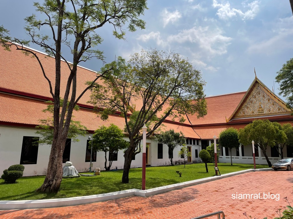
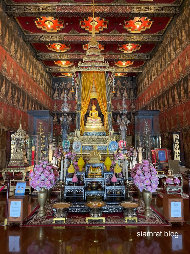
A similar arrangement is used in all Buddhist temples throughout the region, from Bangkok’s Grand Palace down to the humble village temple. A central sacred Buddha image is enclosed within the central ubosot. Walls surround this most sacred space, the gates having lions or mythical animals protecting the inner sanctum. This symmetrical geometric pattern is known as a Mandala and recurs throughout Buddhist thought. As well as being applied to temples it was applied to the traditional walled towns of South East Asia (Mandalay in Myanmar was perhaps the last such city being founded in 1857). The king’s palace together with a powerful sacred Buddha image would form a central axis for a city. Entry to this sacred centre would be prohibited to commoners. The city would be demarcated by concentric defences around the king’s palace, then around the high nobles and finally commoners living in the outer area.
Knowledge of Buddhist cosmology came down to the Siamese through the Traiphumikatha or “Sermon on the Three Worlds” text which was written by King Li Thai who ruled Sukhothai in the fourteenth century. In the aftermath of Ayutthaya’s fall in 1767 the new ruling elite looked to reform and purify Buddhist practice. Both King Taksin and his successor King Rama I considered the Traiphumikatha so important that they ordered new versions to be written during their reigns.
Unfinished Plans at Thonburi
After the destruction of the old capital Ayutthaya by the Burmese in 1767, King Taksin regrouped his forces to the south at an old guard post known as Thonburi. This was a useful base from which to conduct ongoing military campaigns to re-establish control of Siamese territory but it was never officially consecrated as the new capital. Thonburi was protected on its western side by a moat and defensive wall running from Khlong Bangkok Noi in the north to Khlong Bangkok Yai in the south. Although long gone the route of this moat is still marked by Isaraphap Road. An outer moat was also dug a further 400m west but due to manpower shortages it was never more than a ditch with an earthen wall and was abandoned after a short time.

But the defences of Thonburi were not limited to the west side of the river. A defensive moat and wall was also built on the eastern side of the river. Now known as Khlong Khu Mueng Doem, Old City Canal, this moat carved out an area of land on the east side of the river now known as Rattanakhosin Island, roughly matching that of Thonburi on the west bank.
The spiritual centre of Thonburi was Wat Bang Wa Yai (Today known as Wat Rakhang Khositaram) where King Taksin’s Supreme Patriarch of the Buddhist order resided. In the southernmost position of the city stood King Taksin’s rather modest palace, now known as The Old Palace, Wang Doem. On the east side of the river to the north of the centre point stood the residence of King Taksin’s son, the Uparat or heir presumptive. There is evidence that King Taksin had plans to build a larger palace for himself just south of this, roughly where today’s Grand Palace stands.

Although rudimentary, by 1782 the geometric axes of the Thonburi mandala were laid out by the positioning of Wat Bang Wa Yai, the uparat’s palace and Wang Doem.
The rudimentary Thonburi Mandala in 1782 (Green circle) centered on Wat Bang Wa Yai.
Black: Outer Defensive walls. Red: Central mandala axis
Moving to the East
King Taksin’s plans for the new capital were cut short in April 1782 when he was deposed in a coup. His top commander Chao Phraya Chakri took the throne and was crowned King Phra Phutthayotfa (Rama I). On the 21st April 1782 just two weeks after this coup the ceremonial erecting of a city pillar on Rattankhosin Island marked the founding of Bangkok. The speed with which the move across the river was accomplished strongly suggests that King Taksin and his nobles had already been planning this.

The Bangkok city pillar shifted the spiritual centre of the city to the east side of the river. King Rama I quickly had a new moat dug further to the east, Khlong Rop Krung, which roughly doubled the defended area of the new capital. The city pillar is at the geometric centre of this enlarged territory marked by Thonburi’s old moat to the west and Khlong Rop Krung to the east. To the south of the city pillar King Rama I built his new Grand Palace, Wang Luang, and to the south of this were the residences of his chief nobles. To the north of the city pillar stood the Front Palace, Wang Na, the palace of King Rama I’s younger brother Maha Sura Singhanat, the Uparat or heir presumptive. This arrangement was mirrored on the Thonburi side of the river, with the Old Palace, Wang Doem, becoming the residence of a royal family elder and later Rama I’s eldest son, whilst the Rear Palace, Wang Lang, situated opposite the Front Palace, became the residence of the Deputy Uparat.
In 1784 a Brahman temple Devasathan was built in the eastern area along the east-west axis marked by Wat Rakhang Khositaram and the City Pillar. In front of this temple was erected the famous giant swing Sao Ching Cha used in Brahmin rituals. The area is now dominated by Wat Suthat which was built in 1807.

Symmetry across the river was strengthened by the pairing across the river of key temples; Wat Rakhang with Wat Mahathat and Wat Arun with Wat Chetuphon (Wat Pho). The new mandala was surrounded by the city wall with 16 spired gates and 16 defensive bastions corresponding to the 32 deities surrounding Indra’s palace on Mount Meru.
By 1784 the larger Bangkok mandala straddling both sides of the Chao Phraya river was centered on the City Pillar and had strong symmetry in the siting of temples and palaces both north and south and across the river
The enlarged Bangkok Mandala 1785 (Green circle) centered on the City Pillar .
Black: Outer Defensive walls. Red: Central mandala axis’
A New Celestial City
Festivities to celebrate the founding and naming of the new city were held in 1785. Famously Bangkok was given the longest name in the world, Krung Thep Mahanakhon Amon Rattanakosin Mahinthara Yuthaya Mahadilok Phop Noppharat Ratchathani Burirom Udomratchaniwet Mahasathan Amon Piman Awatan Sathit Sakkathattiya Witsanukam Prasit, basically a short poem extolling the virtues of this new sacred city; “City of angels, the glorious city, where the eminent jewel of Indra resides, the great city Ayutthaya of Indra, the grand capital of the world endowed with nine precious gems, the city of delight, abounding in enormous royal palaces resembling the celestial vimāna, where reincarnated gods reign, a city built by Viśnukarma at the consent of Indra”. From the beginning King Rama I was building a sacred celestial city by the Chayao Phraya River which would conform to cosmological design.
But already the sacred symmetry of the mandala was undergoing change. In 1785 the royal chapel Wat Sri Ratana Sasadaram was built, more commonly known as Wat Phra Kaew. Here was held the sacred Emerald Buddha, Phra Kaew Morakot, which Rama I himself had bought back from Vientiane in 1779. The Emerald Buddha became the Buddhist talisman of the new city and usurped the spiritual role of the City Pillar.

In 1795 another powerful Buddha image, the Phra Sihing, was bought from Chiang Mai and installed in the Phuthai Sawan Throne Room of the Front Palace. Between the Grand Palace and the Front Palace the Royal Cremation Ground, Thung Phra Men, was laid out. These were inaugurated in 1797 with elaborate funeral rites for the father of Rama I who had in fact died 30 years earlier in the immediate aftermath of Ayutthaya’s destruction.
With the alignment of these two powerful Buddha images and the ritual Royal Cremation Ground the sacred north-south axis of the city moved westwards away from the City Pillar. Meanwhile the Thonburi half of the city declined in importance. After the Rear Palace had been built in 1785 no new palaces were built in Thonburi, whilst other palaces were downgraded as their royal occupants passed away. In 1806 the deputy uparat Somdet Phra Chao Lan Ther died and the Rear Palace itself was downgraded leaving Thonburi with no high ranking royal residents. The sacred royal city was now centred solely on Rattanakosin Island.
The Bangkok mandala became divided north and south across the Royal Cremation Grounds between the king’s family and that of the uparat. In the latter years of his reign Rama I built 10 palaces for his sons and one grandson around the Grand Palace. Meanwhile four palaces were built by the uparat Maha Sura Singhanat around the front palace for his own sons. In the king’s zone Wat Chetuphon (Wat Pho) was sponsored by Rama I and held hundreds of Buddha images that the king himself had bought back from vassal states. To the north Wat Mahathat was sponsored by Maha Sura Singhanat who built the magnificent mondop there to house the remains of his father, the progenitor of the Chakri dynasty.

King Rama I died in 1809 but both the dynasty and the kingdom continued to flourish. By 1851 when Rama III died a total of 40 palaces had been built for sons of either the king or the uparat. The inner citadel on Rattanakosin island was too small to contain this growth and more than half of these palaces were built within the outer zone demarcated by Khlong Rop Krung, the zone previously reserved for non-royal nobles.
The Bangkok Mandala 1809 (Green circle) now centered on the Emerald Buddha, excluding Thonburi.
Black: Outer Defensive walls. Red: Central mandala axis
The Demise of the Mandala
As the nineteenth century progressed commercial activity increased and commoners increasingly mingled with the elite within the previously sacred centre of the city. Pressures on the expanding city were such that in 1851 King Rama IV had a new moat dug to the east, Khlong Phadung Krung Kasem, marking a new outer perimeter for the city. Due to costs plans to build a new outer wall were never implemented and only six token fortress were constructed alongside the moat. Its defensive role was thereby greatly reduced and its symbolic role as the boundary of the mandala was almost forgotten. But the moat did become a convenient transport route for people and commerce in the outer eastern area.

By the reign of King Chulalongkorn (Rama V) (r.1868 – 1910) the old ideas of Buddhist cosmology were competing with and often losing out to Western beliefs and methods. In 1874 a power struggle erupted into open conflict between the uparat and the young king. Known as “The Front Palace Crisis” it was resolved with British support in favour of the king. When the uparat died a decade later, Chulalongkorn took the opportunity to abolish this traditional post, naming his eldest son as heir apparent in European fashion. The walls of the Front Palace were demolished and in 1887 the palace was re-purposed as a European style “National Museum”. The old separation of zones for the king and the uparat was now gone.

Western style urban planning accelerated when King Chulalongkorn returned from his first Grand Tour of Europe in 1897. Inspired by what he had seen in the capitals of Europe, the king embarked on building a new palace compound called Suan Dusit 2km north of the Grand Palace, connected to the old palace by a grand European style boulevard, Ratchdamnoen. The ceremonial centre-piece of this new seat of power was the ornate Italian designed Ananta Samakhom Throne Hall. The king departed his sacred abode on top of Mount Meru to live in European style and comfort in the suburbs.

Meanwhile whereas Rama I had prohibited proper bridges from spanning the city’s defensive moats, Rama V sponsored the building of road bridges across the moats and canals of Bangkok. The city walls that had once marked sacred boundaries were torn down and the bricks re-used to construct roads that breached those same boundaries. Modern roads soon radiated outwards from the old city centre and the city gates that had previously been opened only for those whose status was high enough to enter the inner realm were now torn down so that commercial traffic could pass unhindered.

Celestial Palaces Become Government Departments
As King Chulalongkorn’s administrative reforms progressed in the last years of the nineteenth century, the final steps in the dissolution of the old sacred mandala took place. As new government ministries were created to build a modern national administration, palaces were replaced by ministerial headquarters. Examples included the Ministry of Defence, which was built on the site of three disused palaces near the City Pillar, the Ministry of Foreign Affairs moved in to Saranrom Palace and the Ministry of Commerce (now the Museum Siam next to Sanam Chai MRT station) was built on the site of five former palaces.
The centre of the City of Angels was becoming de-sacralised as the “royal palaces resembling the celestial vimāna” were converted into museums and government ministries.

At the Sanam Chai MRT station opened in late 2020 there is an interesting display about the history and archaeology of the area just south of the Grand Palace. A video explains the transition of five palaces into the Ministry of Commerce (Now Museum Siam).
Post-Mandala Bangkok of 1910 showing roads radiating outwards from Ratanakhosin.
Yellow : Ratchdamnoen Dark Blue: Major Roads
Buy Me a Coffee

References
- Edward Van Roy. The Rise and Fall of the Bangkok Mandala. Journal of Asian History, Vol 45. 2011.

Across Southeast Asia, the mandala model shaped many capitals, not only Bangkok. The Majapahit capital, Trowulan, in East Java, for instance, was structured on the mandala principle, with sacred and political spaces arranged to mirror the cosmic order. This tradition carried forward into later Javanese cities such as Yogyakarta and Surakarta, both of which still preserve their mandala-based layouts. In these cities, the palace (kraton) occupies the sacred center, aligned along a clear mountain–sea axis: Mount Merapi to the north representing the cosmic mountain, and the Indian Ocean to the south symbolizing the cosmic sea. This enduring alignment reflects the same cosmological symbolism that once shaped Bangkok’s early urban form, linking royal authority with universal harmony.
LikeLike